


This page provides useful information about the Project and answers to people’s most commonly asked questions.
This page is regularly reviewed and updated but should you have a question that isn’t answered on this page, please contact contact@northfallsoffshore.com.
Landowners and those with an interest in land can access February 2024’s information document here, and January 2025’s information document here.
The Project is proposing to develop and construct a new offshore wind farm comprising up to 57 offshore wind turbine generators (WTGs), and their associated foundations, located approximately 40 kilometres off the East Anglia coast at its nearest point.
The offshore cable route runs from the 95 square kilometre offshore Project area to landfall at Kirby Brook, Essex.
Onshore export cables will then transport the electricity in a broadly westerly direction approximately 24 kilometres to the proposed onshore substation located west of Little Bromley, near Ardleigh, before it enters the national electricity network.
The onshore export cables will be entirely buried to minimise visual and environmental impact.
Please note that the construction of pylons is not included in the Project’s Development Consent Order (DCO) application.
North Falls received development consent from the Secretary of State on 14 May 2026. See here from a statement from the Project. Now that the Project has received development consent from the Secretary of State, it is able to proceed to construction, subject to securing a Contract for Difference (CfD) and Final Investment Decision.
There is now a six-week period in which the decision may be challenged in High Court. This process of legal challenge is known as Judicial Review.
The current status page provides more information about what’s going on with the Project now and what comes next. This page will be consistently updated as the Project makes its way through the National Infrastructure consenting process.
National Grid Electricity Transmission (Sea Link), North Falls Offshore Wind Farm (North Falls) and Five Estuaries Offshore Wind Farm (Five Estuaries) have been working together to explore the potential for offshore coordination as part of the Offshore Transmission Network Review (OTNR) “Early Opportunities” workstream. The projects, acting together in a consortium led by North Falls, were awarded funding by the Department for Energy Security and Net Zero through the Offshore Coordination Support Scheme (OCSS) in December 2023.
The Secretary of State has decided not to grant further funding to explore the potential for offshore coordination as part of the Offshore Transmission Network Review (OTNR) “Early Opportunities” workstream.
On 28 March 2024, the consortium submitted a high-level feasibility study that formed the first step of the grant funding agreement. The study assessed the feasibility of a coordinated offshore connection, specifically:
• Capital costs.
• Building blocks.
• Construction and commissioning methodologies.
• Overall programme associated with a coordinated solution.
While the Secretary of State has decided not to grant further funding, an offshore coordinated connection remains a connection option with North Falls’ Development Consent Order (DCO) application. This option safeguards against the possibility of the current onshore connection option changing, and a viable offshore coordinated connection option being brought forward by an alternative party that still allows North Falls to be operational by 2030.
The Secretary of State has decided not to grant further funding to explore the potential for offshore coordination as part of the Offshore Transmission Network Review (OTNR) “Early Opportunities” workstream.
While the Secretary of State has decided not to grant further funding, an offshore coordinated connection remains a connection option within the Project’s DCO application.
Retaining an offshore coordinated connection option within the Project’s DCO application safeguards against the possibility of the current onshore connection option changing, and a viable offshore coordinated connection option being brought forward by an alternative party that still allows the Project to be operational by 2030.
The Project has submitted, as part of its DCO application, three options for connecting to a National Grid connection point:
• Option 1: Onshore electrical connection at a National Grid connection point within the Tendring peninsula of Essex, with a Project alone onshore cable route and onshore substation infrastructure.
• Option 2: Onshore electrical connection at a National Grid connection point within the Tendring peninsula of Essex, sharing an onshore cable route and onshore cable duct installation (but with separate onshore export cables) and co-locating separate Project onshore substation infrastructure with Five Estuaries Offshore Wind Farm.
• Option 3: Offshore electrical connection, supplied by a third party.
Options 1 and 2, with a connection point within the Tendring peninsula of Essex, are currently the only grid options provided by National Grid and therefore available to North Falls at this point in time.
National Grid Electricity Transmission (NGET) is responsible for operating the electricity transmission network in England and Wales.
The Connection and Infrastructure Options Note (CION) process is the mechanism used by NGET to evaluate potential transmission options for generation projects (like North Falls Offshore Wind Farm) to identify a suitable connection point, in line with their obligation to develop and maintain an efficient, coordinated and economic electricity transmission network.
As a result of this assessment, NGET offered the Project a connection located in the vicinity of Ardleigh as part of NGET’s Norwich to Tilbury Project. NGET has also offered Five Estuaries Offshore Wind Farm the same onshore connection option. Five Estuaries Offshore Wind Farm’s proposed substation location has been refined to an area west of Little Bromley and this area also coincides with the Project’s proposed substation location. The two projects’ proposed substation locations are therefore what we refer to as ‘co-located’.
The co-location of the two projects’ proposed substation locations creates valuable opportunities for effective coordination and collaboration between the two projects and is expected to enhance coordination not only during the planning and construction phases but also in the long-term operational and maintenance phases of the projects.
North Falls and Five Estuaries have coordinated extensively on their development proposals, to include:
• An aligned landfall location for the offshore export cables to come ashore;
• A shared onshore export cable corridor; and
• An overlapping onshore substation zone for the co-location of the prospective substations.
Furthermore, North Falls and Five Estuaries have coordinated during the pre-application process and have undertaken joint working groups with relevant stakeholders on a number of technical matters. Both projects are committed to ongoing coordination at the construction stage where there is the potential for coordination in delivery of the two projects. This has been facilitated within each DCO application, including the ability for one project to lay ducting for the other, and shared use of accesses and compounds.
While North Falls and Five Estuaries Offshore Wind Farm coordinate and are similar projects in close proximity, they are ultimately separate projects with separate shareholder groupings and subject to their own programmes and DCO applications.
More information on coordination with Five Estuaries and other neighbouring projects can be found in the Coordination Report.
The onshore Project area and onshore substation works area have been defined following six years of engagement and consultation and an extensive site selection process, which has sought to take account of landscape and visual, environmental, engineering, planning and land requirements. The site selection process is described in detail in the Site Selection and Assessment of Alternatives chapter (document reference 3.1.6) of the Environmental Statement.
More information about the engagement and consultation undertaken on the Project can be found in the Consultation Report (document reference 4.2).
Both the Project and Five Estuaries Offshore Wind Farm have reduced the number of export cable circuits required from a maximum of four per project to two per project. This decision has enabled a reduction in the width of the proposed combined onshore cable corridor during construction from up to 243 metres to predominantly around 90 metres.
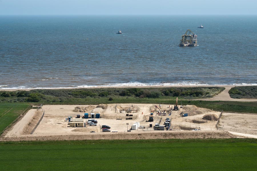
After careful examination of environmental assessments, consideration of consultation feedback, and various factors like engineering feasibility, nature reserves, land use, historic sites, and technical feasibility, the Project has proposed an area near Kirby Brook where the cables will be brought ashore. This location is referred to as ‘landfall’ and was chosen to avoid direct interference with the Holland Haven Marshes, Frinton Golf Club, and a designated Site of Special Scientific Interest.
To bring the cables onshore, a method called horizontal directional drilling (HDD) will be used. This technique helps reduce impacts on the coast and seawall. By selecting this particularly landfall location, the Project is aligning with Five Estuaries Offshore Wind Farm, providing a better opportunity for the projects to coordinate their construction work at the proposed landfall site. The site selection process for landfall is described in detail within the Site Selection and Assessment of Alternatives chapter (document reference 3.1.6) of the Environmental Statement.
 Indicative image of horizontal directional drilling (HDD) (Sofia Offshore Wind Farm).
 Indicative image of horizontal directional drilling (HDD) (Triton Knoll Offshore Wind Farm).
 Indicative image of drainage works (Sofia Offshore Wind Farm).
Yes, the two projects’ proposed substation locations are co-located. This creates valuable opportunities for effective coordination and collaboration between the two projects and is expected to enhance coordination not only during the planning and construction phases, but also in the long-term operational and maintenance phases of the projects.
The maximum onshore substation platform footprint would be 280 by 210 metres. The maximum onshore substation equipment height is 18 metres.
See page 94 of the Project Description chapter of the Environmental Statement for the onshore substation parameters. See section 5.7.4 of this chapter for more information regarding the onshore substation and grid connection.
The Project’s Design Vision sets out the proposed approach to the design of the Project’s onshore substation and its associated infrastructure. Further information can also found in the October 2024 newsletter, available here.
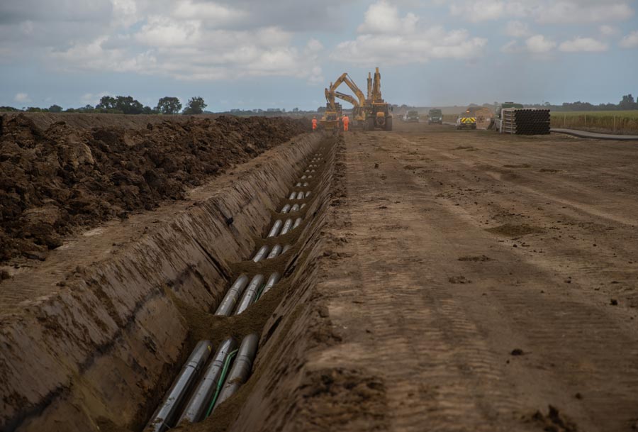
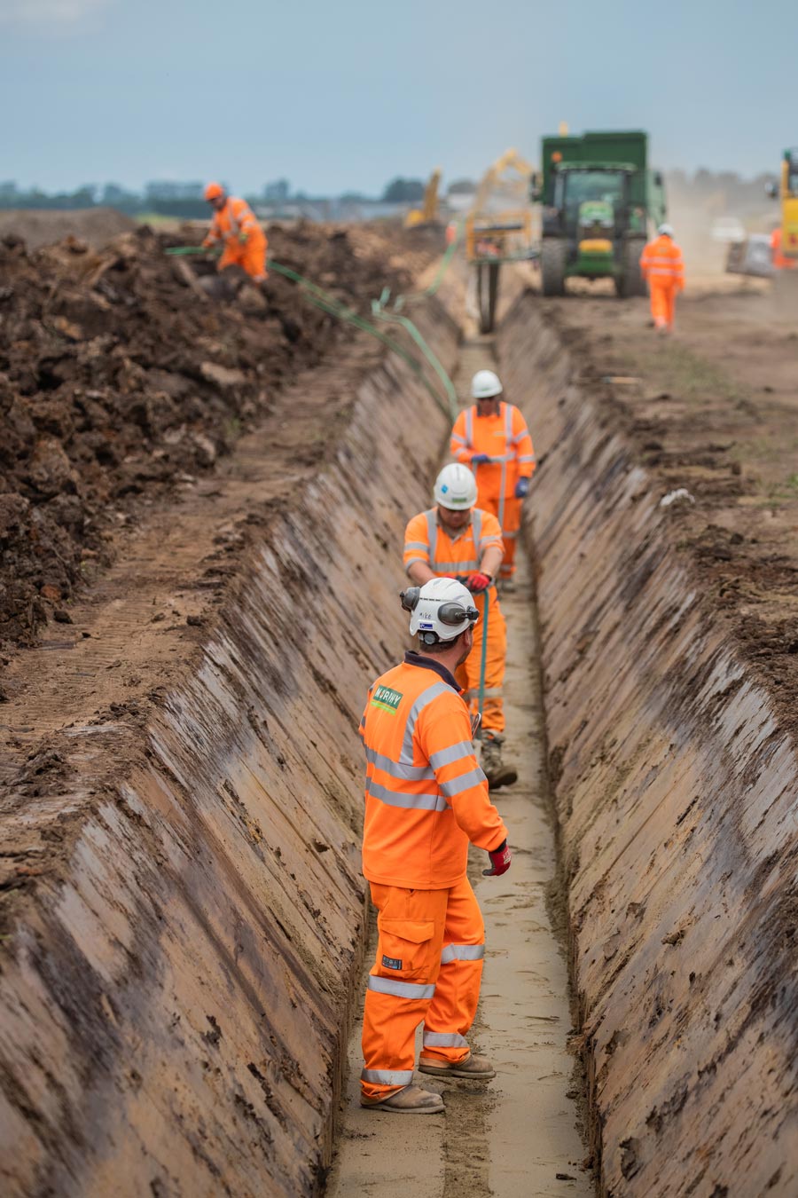
During construction there will be one trench per cable circuit (one each for the Project and Five Estuaries Offshore Wind Farm), and each trench would be up to 3.75 metres wide at the surface reducing to 1.2 metres at the base. An area is required for subsoil and topsoil storage either side of the permanent cable corridor during the works.
The cable circuits must be spaced out to minimise the mutual heating effect. This spacing enables the cables to effectively carry the large power volumes required without overheating and damaging the cables.
The exact location and width of each trench will be finalised closer to the construction phase but will allow for soil storage, internal haul roads and possible micro-siting, plus the flexibility to use HDD under constraints such as roads.
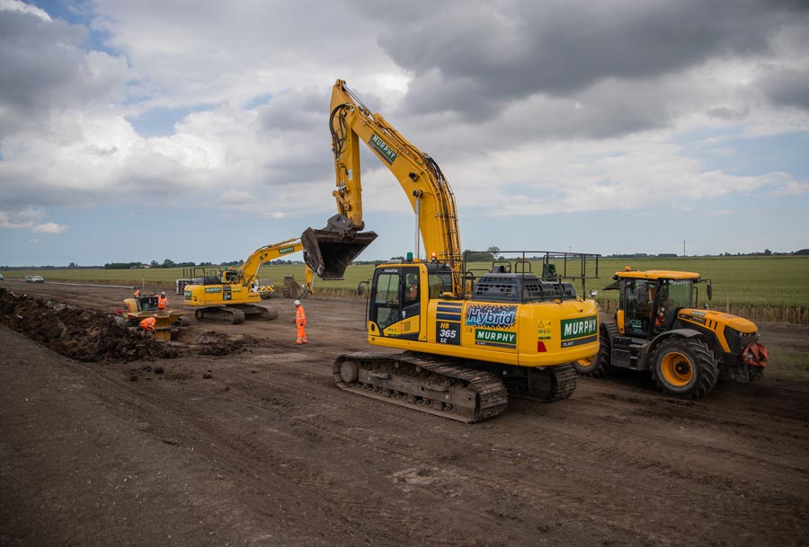
More information on construction and proposed construction methodology is described in the Project Description chapter of the Environmental Statement.
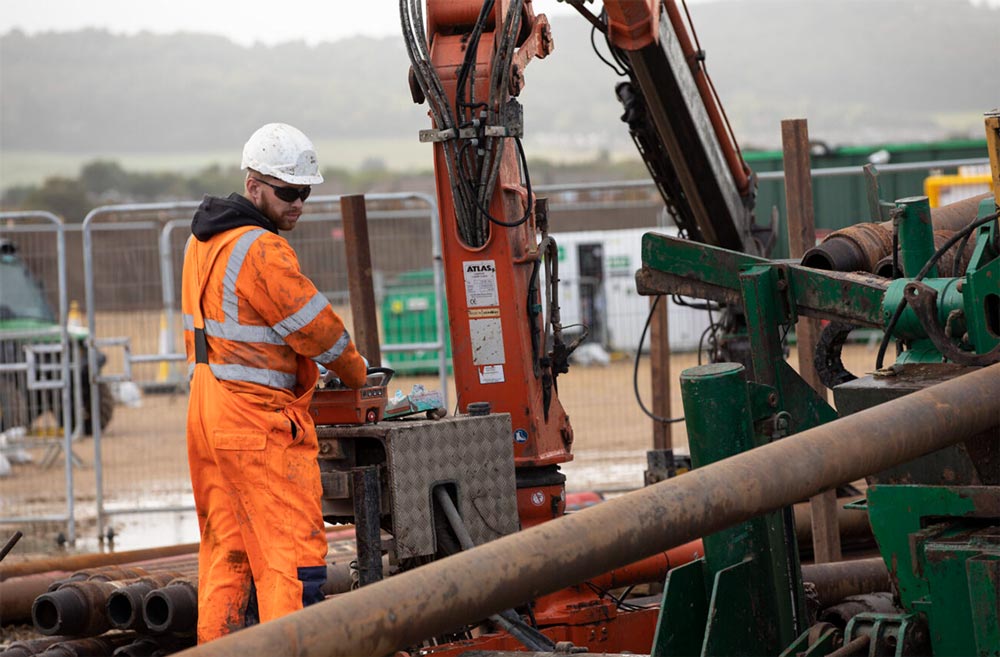
 Indicative image of onshore cable installation works (Triton Knoll Offshore Wind Farm).
 Indicative image of onshore cable installation works (Triton Knoll Offshore Wind Farm).
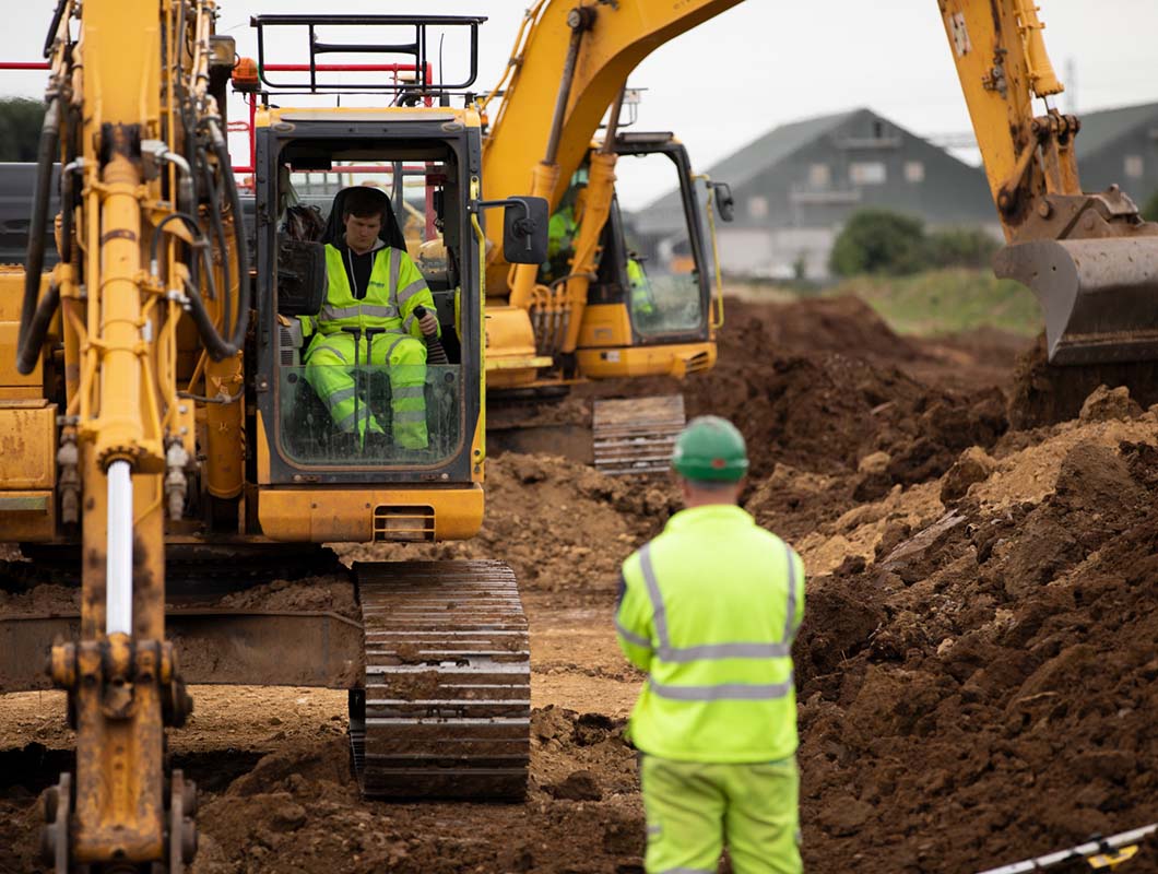
 Indicative image of temporary haul road construction (Triton Knoll Offshore Wind Farm).
The Project has produced an Outline Code of Construction Practice (CoCP) which is provided to secure mitigation identified through the Environmental Impact Assessment process for the onshore components of the Project only. A final CoCP will be produced prior to construction of the Project and will be in accordance with the Outline CoCP and the final design of the Project. The CoCP is secured by a requirement of the Draft DCO.
The Outline CoCP covers a large range of topics including how any effects from dust, noise, light, air quality, water / pollutant management and waste will be mitigated. The document also sets out the management measures which the Project will require all personnel on site to adopt and implement for any onshore construction works.
Interested parties will be able to provide feedback on the Outline CoCP as part of the Examination process.
Water quality sampling has been undertaken on selected properties that rely on water abstraction from wells and boreholes. This initial sampling has helped to establish a baseline understanding of current water quality and conditions. The Ground Conditions and Contamination chapter of the Environmental Statement identifies sensitive receptors (including groundwater) and provides details on management and mitigation measures proposed to reduce impacts.
The Outline CoCP also contains control measures required for each phase of onshore works to manage any possible contamination of land and groundwater.
An Outline Construction Traffic Management Plan (CTMP) has been submitted alongside the Project’s DCO application and will be further developed and agreed with stakeholders such as Essex County Council and National Highways prior to construction. The Outline CTMP will form the basis for a final CTMP for each phase of the Project’s onshore works, which will be prepared and submitted for approval to the local planning authority prior to the commencement of construction of the relevant phase. This will be secured as a requirement of the Project’s DCO.
Temporary fencing will be required prior to construction to demarcate the working area, including the proposed substation site and temporary construction compounds. Details of fencing will be submitted to the relevant planning authorities for approval before installation and a Construction Fencing Plan will be included within the final CoCP. Some fenced areas may include security gates to control access and egress. If needed, crossing points can be discussed and established where suitable and reasonable to do so, to allow continued access to severed land.
Onshore export cables will generally be buried at a depth not shallower than 1.2 metres below ground level depending on ground conditions. Where necessary, for example if there is rock, concrete or another obstacle close to the surface, the cables may need to be laid at a shallower depth, with warning tape or tiles placed not less than 0.9 metres below the surface.
Jointing bays are underground structures required at regular intervals along the onshore cable corridor to join sections of cables together. Link boxes allow onshore export cables to be bonded to earth to maximise cable ratings and are located close to the cables at jointing bay locations.
Link boxes are not required at all jointing bay locations, but as a worst-case scenario could be required at a frequency of one every 500 metres. The number and placement of the link boxes would be determined as part of the Project’s detailed design, which will be developed post consent. Where possible, the link boxes would be located adjacent to field boundaries and in accessible locations because post construction, technicians will require periodic access for inspection and testing. The only above ground infrastructure would be similar to a manhole cover to allow for maintenance. Where necessary, manholes will be demarked using marker posts to ensure protection of the asset.
All efforts will be made to minimise the extent of hedgerow disturbance by utilising existing gaps in field boundaries. Additionally, trees which have been identified for retention will be worked around using techniques to safeguard the root protection zone.
Wherever a hedgerow crossing is unavoidable and the hedgerow requires removal, this work will be undertaken prior to topsoil removal. The width of the hedgerow removed will be limited where practicable and all removed hedgerows and trees will be replaced with locally appropriate native species.
Details of the potential effects of the Project on trees and hedgerows in the local area can be found in the Tree Preservation Order and Hedgerow Plan.
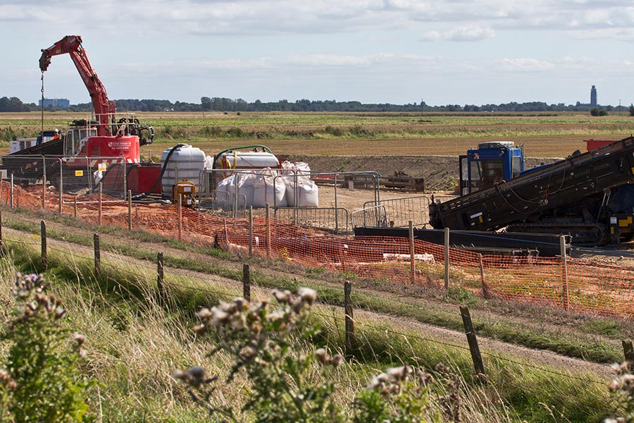
A temporary construction compound (TCC) is a secure, fenced, temporary area along the onshore cable corridor which will help to facilitate construction. The area will be hard standing for suitable storage of materials, vehicles and welfare units. The areas will be reinstated following completion of construction. It is estimated there will be up to 11 site compounds required along the onshore cable corridor, plus an additional landfall TCC.
More information on TCCs can be found in the Project Description chapter of the Environmental Statement.
 Indicative image of temporary construction compound (TCC) (Triton Knoll Offshore Wind Farm).
 Indicative statement of land reinstatement (Triton Knoll Offshore Wind Farm).
Construction is currently expected to begin in 2027. The installation of onshore export cables is a linear construction project with an anticipated overall construction duration of between 18 to 27 months. As the construction works are comprised of a variety of activities, the duration of each activity at any location will be dependent on the construction activity being undertaken.
Typically, the onshore cables will be installed into ducts that will be laid in a mechanically excavated trench using what’s referred to as an ‘open cut’ method. The ducts are placed in trenches initially and then the cables pulled through after the trenches have been backfilled. A layer of stabilised backfill material such as cement bound sound (CBS) is generally used to ensure a consistent structural and thermal environment for the cables before backfilling with selected excavated soil.
If trenching is not suitable, for example if there are ecological or other features to avoid, an alternative method will be implemented. This may include HDD, which is a steerable trenchless method of installing underground cables over relatively short distances with minimal or no impact to the surface above.
The rate at which ducting for electricity cables can be laid each day can vary based on several factors, including soil conditions, equipment used, and site constraints. In general, the installation speed depends on the construction method employed, whether it’s open cut trenching or trenchless methods such as HDD.
For open cut trenching, the installation rate could be in the range of several hundred metres per week, depending on conditions and the nature of the terrain. On the other hand, HDD can be slower but offers advantages in terms of minimising surface disruption. The number of teams associated with the installation of the onshore export cables is yet to be determined, as is the length of onshore cable route to be worked on each day.
Later in the construction programme the cables would be pulled through the pre-installed ducts. This process is repeated for all cables required for the two cable circuits (six power cables and two fibre cables). All cables will then need to be jointed to each other to form a continuous cable to take power from the offshore wind turbine generators to the proposed National Grid substation. The cable pull would take place from jointing bays located approximately every 500 metres along the onshore cable route.
The duration for HDD construction depends on a number of factors, including ground conditions and the required drilling length.
For most HDDs, we expect to be completed within two to four weeks, with some additional time for mobilisation / demobilisation and preparation / reinstatement works for the activity. More complex HDDs, such as going under a railway line, or the main landfall HDD, will likely take longer.
Where practicable, footpaths and bridleways will be maintained to minimise disruption to users. Where the Project intersects with a footpath or bridleway, a suitable temporary diversion will be created while works are taking place. A full list of temporary diversions will be included within a Public Right of Way (PRoW) Management Plan, which will be approved by the local planning authority. Information on duration and proposed alternative routes will be circulated publicly through site notices and local media and PRoW or other access tracks temporarily diverted during construction will also be reinstated to their original route.
PRoWs are considered further in the Tourism and Recreation chapter of the Environmental Statement.
Drainage systems will be maintained before, during and post construction. The Project and Five Estuaries Offshore Wind Farm are seeking to jointly instruct an independent drainage consultant to undertake an assessment of existing drainage systems by carrying out an initial walkover survey prior to construction. If alterations are to be made to the existing drainage system, the drainage consultant will prepare a design and scheme for the required drainage work.
More information can be found in the Outline Operational Drainage Strategy.
EMFs are present everywhere in our environment and occur because of moving electric charges. They occur both naturally, for example the earth’s natural magnetic field, and humanmade, for example wherever electricity is generated or transmitted. While the underground cables and substation will produce EMFs, those generated are often referred to as extremely low frequency and have been assessed to have no likely significant population health effects. Put in context, the magnetic field of a buried alternating current (AC) system has a strength of 20-24 μT when standing directly over it. This is equivalent to approximately half of what is expected from a TV, washing machine or bedside clock at the same distance.
The potential operational impacts and likely effects of EMFs are discussed further and assessed in the Human Health chapter of the Environmental Statement.
The Project has provided an initial Biodiversity Net Gain Assessment, provided as part of the Project’s Biodiversity Net Gain Strategy. This document describes potential opportunities for enhancement of terrestrial habitats.
Areas identified as suitable for enhancement will be focused within the onshore Project area (on-site) in the first instance. Off-site (outside the onshore Project area) habitat creation / enhancement as compensation will only be used if there is no suitable alternative on-site, in order to adhere to the mitigation hierarchy.
Tarchon Energy interconnector is being developed by Copenhagen Infrastructure Partners.
North Falls Offshore Wind Farm is being developed as a joint venture between SSE Renewables and RWE and there is no affiliation with Copenhagen Infrastructure Partners.
A summary of feedback received to date can be found in the Project’s Consultation Report.
The Project has considered all feedback received. The Project’s consideration of responses received for stage 3 (statutory) consultation can be found in appendices F.14 and F.14.1 and G.5 and G.5.1 for stage 4 (targeted) consultation.
The Project’s Environmental Statement includes assessments on geology, ground conditions, hydrology and flood risk for each of the project’s construction, operation and decommissioning phases which have informed a Flood Risk Assessment for the onshore infrastructure.
More information can be found in the Water Resources and Flood Risk chapter of the Environmental Statement.
Coastal erosion risk has been assessed as part of the project’s EIA, through the development of a conceptual model of local coastal processes. The electrical cables at the coast will be buried deep underground and the temporary construction compounds will be set back behind the Holland Haven Marshes SSSI, so there would be negligible risk of the works, or the presence of infrastructure, increasing erosion.
The answer to this depends on from where, the time of day and the weather conditions. But assuming from the closest land point to the closest turbines, there will be varying degrees of visibility.
The size and shape of the offshore wind farm array areas was reviewed and in late 2023 it was decided to drop the project’s northern array. This decision took into account various aspects including seascape, with a view to reducing the visual impact on the coast where practicable. As a preview you can see our 3D visualisation of the proposed project from specific onshore viewpoints here.
More information can be found in the Seascape, Landscape and Visual Impact Assessment chapter of the Environmental Statement.
An early study indicated that for the onshore construction phase, local small-to-medium enterprises could benefit from contracts totalling more than £250 million. This initial assessment was built on by a specific socio-economic benefit study that has found the gross value add (GVA) for the local area could be up to £400 million across the supply chain for the lifetime of the project.
While the Project doesn’t anticipate beginning phased construction until 2027, we’re keen to begin early engagement with potential suppliers. Our Online Supplier Registration is now live, where interested suppliers can sign-up for Project updates and in time opportunities to meet with supply chain managers involved in North Falls Offshore Wind Farm and its joint venture partners, SSE Renewables and RWE.
More information can be found in the Marine Geology Oceanography and Physical Processes chapter of the Environmental Statement.
The Project conducted four public rounds of consultation before submitting its DCO application to the Planning Inspectorate. More information on the consultation carried out can be found in the Consultation Report.
The Project does not expect to carry out any further rounds of public consultation. People have the opportunity to engage with the Project further throughout the Planning Inspectorate’s Examination process. We would encourage you to register for Project updates on the Planning Inspectorate’s website here for more information about how to do so.